How to check land for
subsidence before buying
If you find settlement after the purchase, it is your problem at your cost. If you find it before, it is a negotiating position. Most of the check costs nothing. Here is the order that works, from free public sources to a site-specific satellite record.
- 01
Check the regional public record — free
The USGS and state geological surveys document known subsidence areas — from the Houston–Galveston region to California's San Joaquin Valley to Arizona's earth fissure zones. In Europe, the free EGMS service publishes processed ground movement data for the whole continent. If the parcel sits in or near a documented area, everything that follows matters more. Start with our region-by-region index.
- 02
Ask what the ground is made of
Some ground types settle by nature: artificial fill and reclaimed land (consolidation can continue for decades), drained organic soils (they shrink), deep alluvial basins with heavy groundwater pumping, and karst. County soil surveys, historical topographic maps, and old aerial images reveal filled creeks, former ponds, and reclaimed shoreline that the current site plan hides.
- 03
Read the paper trail
Prior geotechnical reports, well logs, and the maintenance history of existing structures (recurring slab cracks, doors that stop closing, repaved aprons) are point evidence. Their limit is also their strength: they describe single points at single past moments, not the recent movement of the whole parcel.
- 04
Get the site-specific movement record
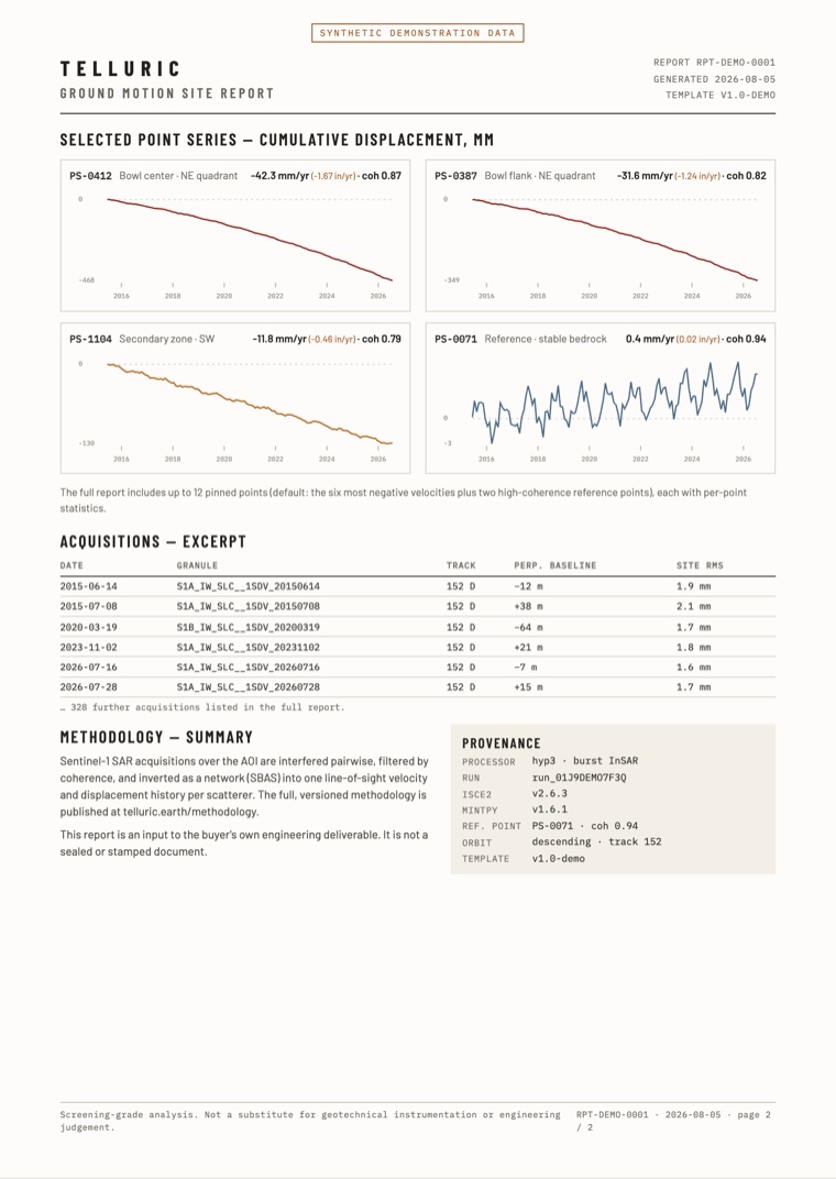
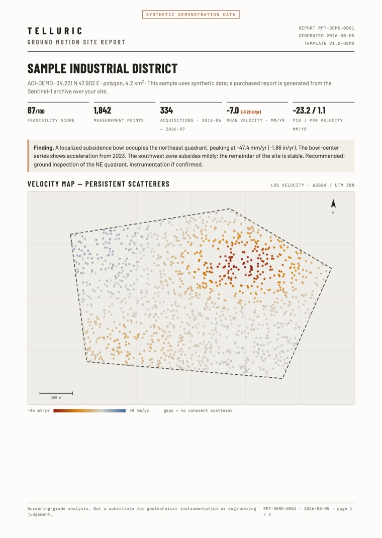
Radar satellites measured the parcel every 6–12 days from 2015 on, whether or not anyone watched. A screening-grade InSAR report reconstructs that record: movement rates and multi-year time series for stable surfaces on and around the site. It shows if the ground held still, sank steadily, or accelerated. It also shows if the movement is uniform or differential — differential movement is what damages structures. The free feasibility check first tells you if the satellites can measure the parcel reliably at all.
- 05
If anything flags — call the engineer
Screening evidence tells you that the ground moves and how fast. A geotechnical engineer determines why, and what it means for your foundation. A movement record that flags something does not kill the deal — it is the document you hand to the engineer, and to the negotiating table. None of these steps replaces a geotechnical investigation where one is necessary.
The deliverable
The report your client sees
The velocity map, the movement history of each selected point, the list of satellite passes, and the processing record. Use it as an input to your own stamped deliverable.
PDF · two pages · synthetic demonstration data
Get the site-specific record
Draw your site, and you get a free feasibility report from the Sentinel-1 radar archive in about one minute. It tells you how many passes cover the site, how often, over what period — and if the satellites can measure it at all. If they cannot, the report says so.
Check your site freeTelluric readings come from satellite radar and are screening-grade: use them to decide where to inspect. They do not replace geotechnical instrumentation or engineering judgment. Read the methodology.